Skip to product information
1 of 5

Backroad Maps

Backroad Maps Willmore Wilderness Provincial Park Map Alberta

Backroad Maps Willmore Wilderness Provincial Park Map Alberta

Regular price $19.95 CAD
Regular price Sale price $19.95 CAD
Sale Sold out
Shipping calculated at checkout.

Willmore Wilderness Provincial Park Map (Alberta) – Remote Backcountry Navigation Guide

Navigate Alberta’s most untouched wilderness with confidence using the Willmore Wilderness Provincial Park Map—a high-detail, field-ready navigation tool designed for serious backcountry travel and expedition planning. Covering one of the largest protected wilderness areas in the province, this map delivers exceptional clarity and reliable detail for off-grid exploration.

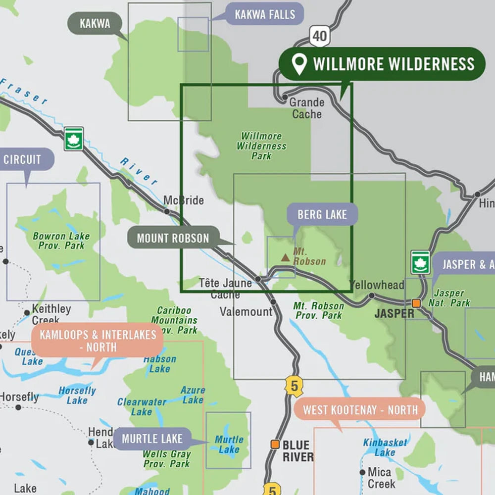
Providing a detailed overview of Willmore Wilderness Provincial Park in Alberta, this recreation map highlights all the access roads and trails, campgrounds and backcountry campsites, trailheads and notable recreation areas, larger lakes and river systems, surrounding areas and more! Using 1:50,000 scale water and road data, this map features topographic relief shading. Included on the map are A la Peche Lake, Berland River, Grande Cache, Hardscrabble Creek, Jackknife Pass, Jackpine River, Morkill Pass, Mountain Trail, Mount Mawdsey, Muddywater River, Muskeg River, Ptarmigan Lake, Rock Lake, Sheep Creek, Smoky River, Sulphur Gates, Sulphur River, Twintree Mountain and more!

Built using 1:50,000-scale water and road data with advanced relief shading, it highlights access routes, trails, campsites, and key natural features—making it an essential tool for navigating this rugged, roadless landscape.

Explore Alberta’s Wildest Terrain
For those heading into one of Canada’s most remote and rugged regions, the Willmore Wilderness Provincial Park Map is an essential navigation tool—delivering the detail, durability, and reliability needed for true backcountry adventure.

Features

Built for True Wilderness Exploration

Willmore Wilderness Park is one of Alberta’s largest protected areas, spanning roughly 4,600 km² of rugged mountains, rivers, and forested valleys with no roads or permanent infrastructure.

This map is specifically designed for that environment—where navigation is critical. It highlights:

Remote trail networks and access points
River systems like the Smoky, Muskeg, and Berland
Backcountry campsites and staging areas
Key passes, peaks, and wilderness routes

With over 750 km of trails and true backcountry conditions, it’s ideal for experienced adventurers seeking self-supported travel in untouched terrain.

Print Features:
Printed on regular water-resistant paper or durable waterproof and tear-resistant material

Includes industry leading cartographic detail and state-of-the-art relief shading

Countless points of interest, hiking trails, campsites, boat launches, paddling routes and more!

Easy to read, large-scale 61 x 94 cm (24 x 37 inch) map at 1:225,000 scale

Seamless map coverage requires no page turning

Why You'll Love This

High-Detail Topographic Mapping – Accurate terrain shading and contour detail for navigation

Comprehensive Recreation Coverage – Trails, campsites, rivers, lakes, and backcountry routes

Covers Remote Wilderness Terrain – Includes areas like Rock Lake, Berland River, Smoky River, and Grande Cache

Large, Easy-to-Read Format – 61 x 94 cm map with seamless coverage (no page flipping)

Durable Material Options – Available in water-resistant paper or waterproof synthetic

Packed with Points of Interest – Hiking trails, paddling routes, campsites, and more

Specifications

Map Scale: 1:225,000
Release: 2021
Dimensions: 61 x 94 cm (24 x 37 Inches)
Dimensions: ~61 x 94 cm (24" x 37")
Material: Water-resistant paper or waterproof synthetic

Area Covered
Willmore Wilderness Provincial Park, Grande Cache, Berland River, Cabin Creek, Hardscrabble Creek, Jackpine River, Mountain Trail, Muddywater River, Muskeg River, Rock Lake, Sheep Creek Trail, Smoky River, Sulphur Gates, Wildhay River, Alberta, Canada

Map Features
Highways, Logging Roads, Land & Water Features, Parks, Adventure Points of Interest, Campgrounds, Hiking Trails, Motorized Trails, Paddling Routes, Hunting & Fishing Areas, Winter Recreation and More.

Carbon-neutral shipping on all orders
View full details